The Sunshine State is bracing for more severe weather in the wake of Hurricane Helene.
Hurricane Milton rapidly intensified to a Category 5 storm on Monday, leading Florida Gov. Ron DeSantis to declare a state of emergency for 51 counties along Florida's western shores.
Several counties, including Charlotte, Hillsborough, and Manatee, have mandatory evacuation orders, with more expected as the storm approaches.
On Sunday, Milton's maximum wind speed was 65 mph. By Monday, it had increased to 155 mph as it made its way across the Gulf of Mexico toward Florida, according to the National Hurricane Center.
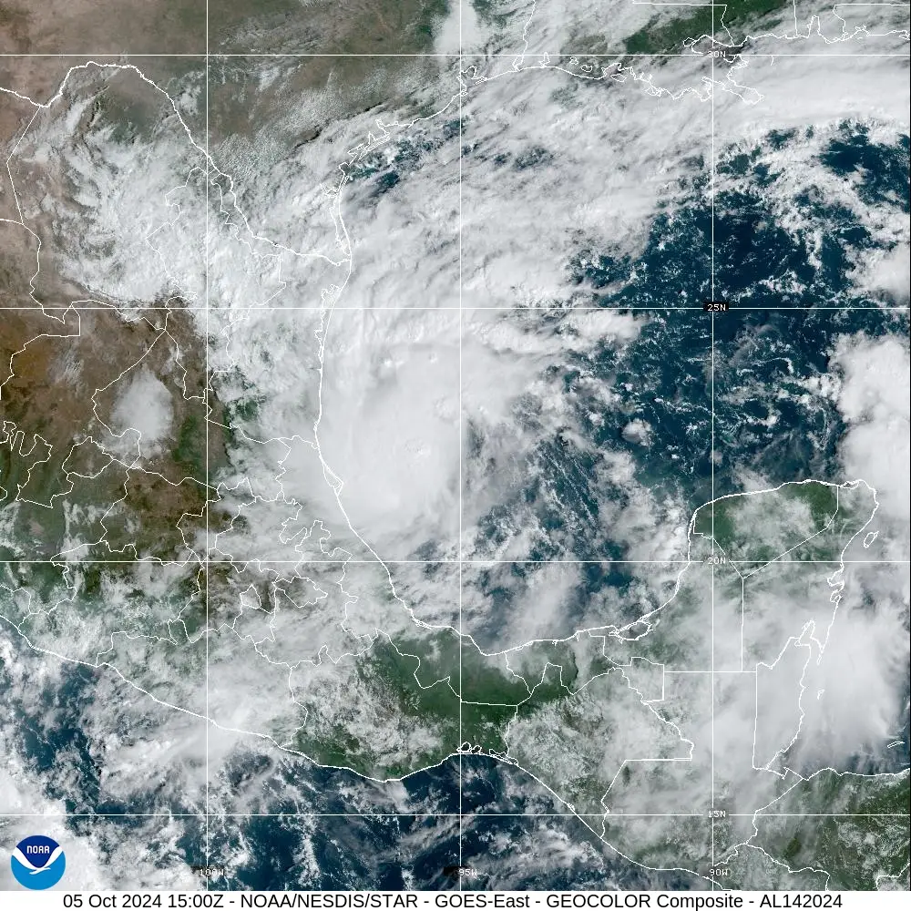
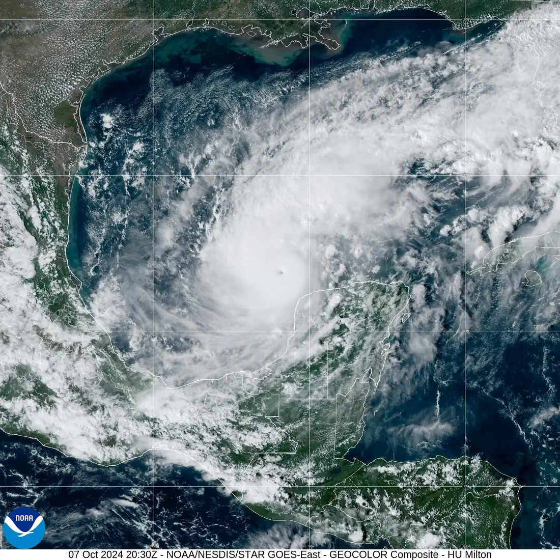
NOAA's GOES-16 satellite is tracking Hurricane Milton from space. Here's a snapshot of the storm's evolution, beginning early Saturday afternoon as a tropical storm with 35 mph winds.

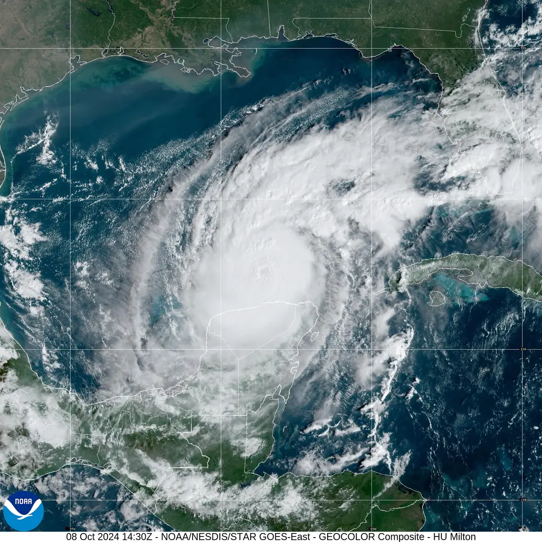
Here's how it looked by Monday afternoon as a Category 5 hurricane with max winds of 180 mph. NOAA forecasters said the storm was moving erratically through the southern Gulf of Mexico.

Milton is one of the most rapidly intensifying storms within the Atlantic Basin.
"This intensification rate is third for the Atlantic basin, behind Hurricane Wilma (2005) and Hurricane Felix (2007), which intensified by 105 mph and 100 mph, respectively," Stephanie Zick, an associate professor for Virginia Tech's Department of Geology, told Business Insider in an email.
Astronauts aboard the International Space Station took this video Monday morning as they flew over the Category 5 storm from a safe distance of 250 miles above Earth.
At 10:28 a.m. EDT October 7, the space station flew over Hurricane Milton and external cameras captured views of the category 5 storm, packing winds of 175 miles an hour, moving across the Gulf of Mexico toward the west coast of Florida. pic.twitter.com/MTtdUosiEc
— International Space Station (@Space_Station) October 7, 2024
Zick said the reason for Milton's rapid intensification is partly due to the size of the storm's eyewall – the region of thunderstorms and high winds just outside of the calm, central eye.
"The storm started out with a relatively small eyewall," Zick said. "Additionally, the eyewall contracts as it intensifies, similar to how an ice skater's spinning rate speeds up as they pull their arms inward."
257 miles above the Earth, external cameras on the @Space_Station captured more imagery of Hurricane #Milton and its eye as the storm approaches the Gulf Coast of Florida. pic.twitter.com/f0tawnzBQC
— NASA's Johnson Space Center (@NASA_Johnson) October 8, 2024
By Tuesday morning, Hurricane Milton had lost some of its strength and is now a Category 4. This isn't necessarily good news for Florida.
Even if the storm weakens, Zick said, its eye could grow larger, which would increase the overall wind field.
"The larger wind field will generate a larger surge, so it's important that Florida residents follow evacuation orders regardless of the exact intensity," Zick said.
Milton is forecast to land over Florida, near Tampa, on Wednesday night. You can see it approaching the state in one of the latest satellite images taken Tuesday morning by GOES-16.

If the storm reaches land during high tide, it could bring with it a storm surge as high as 10 to 15 feet in Tampa Bay, according to the NHC.
With Hurricane Milton following close behind Hurricane Helene, which landed over Florida on September 26, it may seem like this sudden uptick in storms is abnormal.
Matthew Rosencrans, the lead hurricane season forecaster with NOAA's Climate Prediction Center, said that's not the case.
Storms forming over the Gulf are typical for the month of October, though it's slightly abnormal to see this level of activity so early in the month since it usually happens toward the latter half, he said.
Rosencrans added that Milton is probably not the last storm we'll see this season.
He advised people who are not being impacted now but live in hurricane-prone areas to double-check their supplies and be prepared.
"Unfortunately, the hurricane season is not over until November 30th, so I cannot say that this is the last one," he said.
This article was originally published by Business Insider.
More from Business Insider: